Skip to content
Register
Login
Home
About Us
Contact Us
Feedback
Recent Additions
Shop Online
Login
Register
£
0.00
Search for:
Search
Our Range
Antique Maps
County Maps
Foreign Maps
Africa: Continental & Regional
Asia & The Middle East
Australasia & The Pacific
Europe: Continent & Countries
Maps of the World & Misc
The Americas & Caribbean
Great Britain & Ireland with Regional Maps
Renowned Map Makers
Road Maps
Title Pages / Frontispieces
Town Plans
Fairy Range
Other Prints
Topography
Home
/
Antique Maps
/
Foreign Maps
/ Page 11
Foreign Maps
‘SWITZERLAND AND THE PASSES OF THE ALPS.’ by Joshua Archer (‘Gilbert’s Modern Atlas’) c.1843
£
55.00
Add to basket
Add to Wishlist
Add to Wishlist
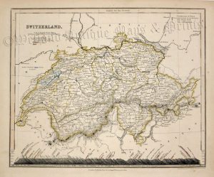
‘SWITZERLAND’ by A. & C. Black c.1873
£
30.00
Add to basket
Add to Wishlist
Add to Wishlist
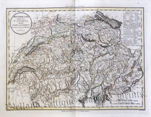
‘SWITZERLAND, Divided into its CANTONS, with their ALLIES and SUBJECTS.’ by J. Russell c.1799
£
95.00
Add to basket
Add to Wishlist
Add to Wishlist
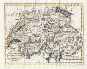
‘SWITZERLAND, with its SUBJECTS and ALLIES From the best AUTHORITIES.’ by Neele / Guthrie c.1815
£
50.00
Add to basket
Add to Wishlist
Add to Wishlist
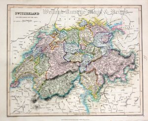
‘SWITZERLAND.’ by Dower / Pertermann c.1850
£
40.00
Add to basket
Add to Wishlist
Add to Wishlist
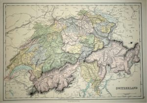
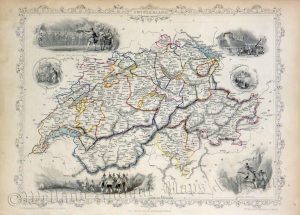
‘SWITZERLAND.’ by John Tallis / J. Rapkin c.1851
£
95.00
Add to basket
Add to Wishlist
Add to Wishlist
Out of stock
‘SYDNEY’ / ‘MELBOURNE’ (double sided map) by J. Bartholomew F.R.G.S. c.1904
£
20.00
Read more
Add to Wishlist
Add to Wishlist
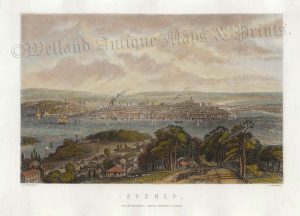
‘SYDNEY.’ by G. F. Sargent / G. Greatbach c.1897
£
46.00
Add to basket
Add to Wishlist
Add to Wishlist
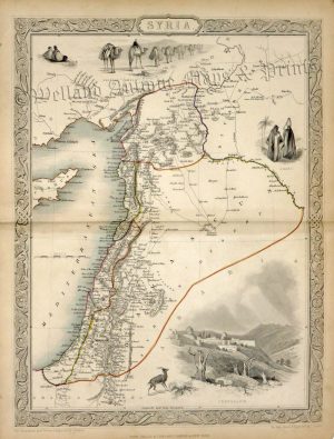
‘SYRIA’ by John Tallis / J. Rapkin c.1851
£
95.00
Add to basket
Add to Wishlist
Add to Wishlist
Out of stock
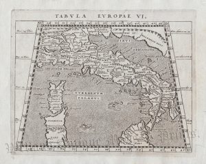
‘TABULA EUROPAE VI.’ (Italy)
£
95.00
Read more
Add to Wishlist
Add to Wishlist
‘TASMANIA OR VAN DIEMEN’S LAND’ by Edward Weller F.R.G.S. c.1863
£
55.00
Add to basket
Add to Wishlist
Add to Wishlist
‘TASMANIA OR VAN DIEMEN’S LAND’ by G. W. Bacon c.1890
£
45.00
Add to basket
Add to Wishlist
Add to Wishlist
‘TASMANIA’ by Edward Stanford c.1885
£
46.00
Add to basket
Add to Wishlist
Add to Wishlist
‘TASMANIA’ from ‘Encyclopaedia Britannica’ c.1880s
£
36.00
Add to basket
Add to Wishlist
Add to Wishlist
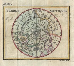
‘TERRES ARCTIQUES’ (The Arctic) c.1739
£
85.00
Add to basket
Add to Wishlist
Add to Wishlist
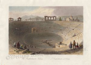
‘The Amphitheatre Verona. L’Amphitheatre de Verone.’ by W. H. Bartlett / J. Sands c.1842
£
36.00
Add to basket
Add to Wishlist
Add to Wishlist
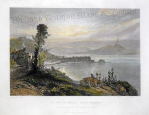
‘THE BAY OF NAPLES: EARLY MORNING.’ by W. Callow / R. Wallis c.1856
£
48.00
Add to basket
Add to Wishlist
Add to Wishlist
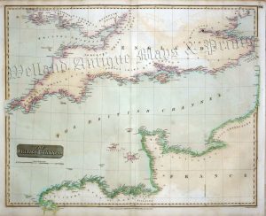
‘THE BRITISH CHANNEL.’ by John Thomson / J. & G. Menzies c.1814
£
175.00
Add to basket
Add to Wishlist
Add to Wishlist
‘THE BRITISH ISLANDS IN THE WEST INDIES’ by J. & C. Walker / S.D.U.K. c.1835 / 1844
£
95.00
Add to basket
Add to Wishlist
Add to Wishlist
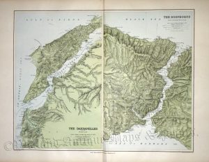
‘THE DARDANELLES AND THE TROAD’ / ‘THE BOSPHORUS AND CONSTANTINOPLE’ by E. Stanford c.1894
£
85.00
Add to basket
Add to Wishlist
Add to Wishlist
Out of stock
‘THE EAST INDIES’ [India & Indo-China] by Sr. Robert De Vaugondy c.1760
£
95.00
Read more
Add to Wishlist
Add to Wishlist
Out of stock
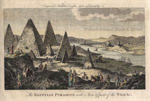
‘The EGYPTIAN PYRAMIDS with a View of part of the NILE &c.’ by Charles Middleton c.1778
£
45.00
Read more
Add to Wishlist
Add to Wishlist
‘THE FALKLAND ISLANDS’ by E. Stanford c.1894
£
110.00
Add to basket
Add to Wishlist
Add to Wishlist
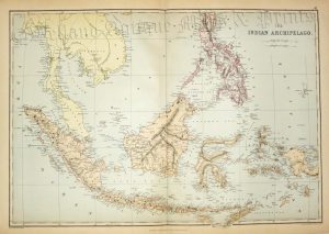
‘THE INDIAN ARCHIPELAGO.’ by E. Weller c.1884
£
55.00
Add to basket
Add to Wishlist
Add to Wishlist
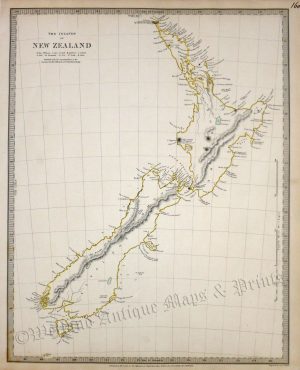
‘THE ISLANDS OF NEW ZEALAND’ by S. D. U. K / J. & C. Walker c.1838
£
200.00
Add to basket
Add to Wishlist
Add to Wishlist
‘THE NETHERLANDS including LIEGE’ [Belgium & Luxembourg] by Robert Wilkinson c.1809
£
36.00
Add to basket
Add to Wishlist
Add to Wishlist
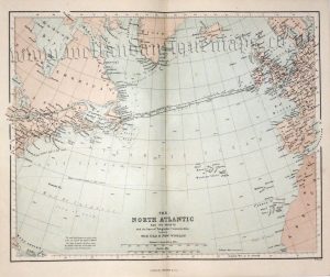
‘THE NORTH ATLANTIC AND ITS COASTS’ (Telegraphic Communication) by W. Hughes c.1868
£
20.00
Add to basket
Add to Wishlist
Add to Wishlist
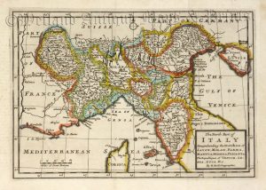
‘The North Part of ITALY Comprehending the Dutchies of SAVOY, MILAN, PARMA, MANTUA, MODENA, TUSCANY &c. The Republiques of VENICE, GENOA, LUCA & c.’ by H. Moll c.1711
£
120.00
Add to basket
Add to Wishlist
Add to Wishlist
Out of stock
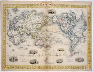
‘THE WORLD (on Mercator’s Projection)’ by T. Starling c.1832
£
55.00
Read more
Add to Wishlist
Add to Wishlist
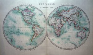
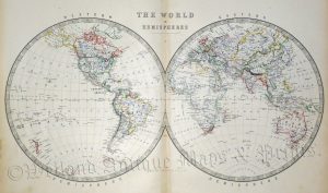
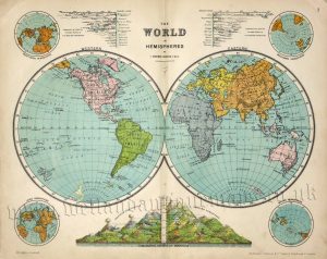
‘THE WORLD IN HEMISPHERES’ by Keith Johnston F. R. S. E. c.1904
£
80.00
Add to basket
Add to Wishlist
Add to Wishlist
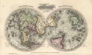
‘THE WORLD IN HEMISPHERES’ by Keith Johnstone F.R.S.E. c.1861
£
95.00
Add to basket
Add to Wishlist
Add to Wishlist
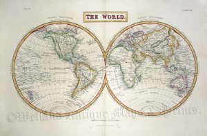
‘THE WORLD IN HEMISPHERES’ by T. Ruddiman Johnston c.1890
£
46.00
Add to basket
Add to Wishlist
Add to Wishlist
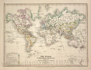
‘THE WORLD IN MERCATOR’S PROJECTION. distinguishing the PRINCIPAL STATES and their COLONIES’ by J. Dower / A. Petermann F.R.G.S. c.1850
£
60.00
Add to basket
Add to Wishlist
Add to Wishlist
‘THE WORLD ON MERCATOR’S PROJECTION SHEWING THE VOYAGES OF CAPTAIN COOK ROUND THE WORLD’ by J. Rapkin / J. Tallis c.1849
£
125.00
Add to basket
Add to Wishlist
Add to Wishlist
Out of stock
‘THE WORLD ON MERCATOR’S PROJECTION’ by John Tallis / J. Rapkin c.1853
£
225.00
Read more
Add to Wishlist
Add to Wishlist
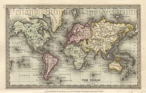
‘THE WORLD’ by T. Starling c.1832
£
65.00
Add to basket
Add to Wishlist
Add to Wishlist
‘THE WORLD.’ by Sydney Hall c.1856
£
120.00
Add to basket
Add to Wishlist
Add to Wishlist
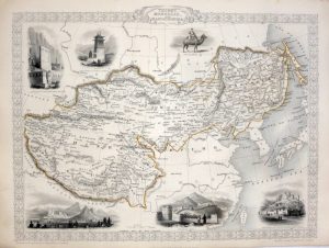
‘THIBET MONGOLIA AND MANDCHOURIA’ by John Tallis / J. Rapkin c.1851
£
125.00
Add to basket
Add to Wishlist
Add to Wishlist
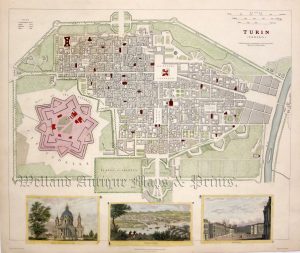
‘TURIN (TORINO)’ by W. B. Clarke / J. Henshall (S. D. U. K.) c.1833
£
110.00
Add to basket
Add to Wishlist
Add to Wishlist
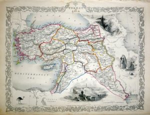
‘TURKEY IN ASIA’ (Turkey and the Middle East) by J. Tallis / J. Rapkin c.1851
£
75.00
Add to basket
Add to Wishlist
Add to Wishlist
←
1
2
3
…
8
9
10
11
12
13
→
Home
About Us
Contact Us
Feedback
Recent Additions
Shop Online
Login
Register
Shopping Basket
Scroll to Top


!['THE EAST INDIES' [India & Indo-China] by Sr. Robert De Vaugondy c.1760](https://www.wellandantiquemaps.co.uk/wp-content/uploads/2023/01/East-Indies-Rodert-De-Vaugondy-02-copy-300x202.jpg)


!['THE NETHERLANDS including LIEGE' [Belgium & Luxembourg] by Robert Wilkinson c.1809](https://www.wellandantiquemaps.co.uk/wp-content/uploads/2023/01/Netherlands-Wilkinson-01-copy-300x237.jpg)