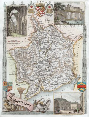
A detailed and decorative late 17th Century map of Monmouthshire which was published in Richard Blome’s Cosmography And Geography (London: 1693).
Richard Blome (1635-1705) was a noted heraldic writer, cartographer and publisher who flourished in the latter half of the 17th century. He was a prolific, if not always original, worker and was thus frequently accused of plagiarism by his contemporaries. In Blome’s defence, he usually cited his sources and, as with all map publishers of the period, did not have the resources to improve on the existing cartographic information available; nevertheless, his maps were attractive and quaintly designed and have retained a certain charm to this day.
- This is an original copperplate engraving with later hand colour.
- Printed area is approximately 18.8cms by 23.8cms.
- The map is in very good condition with adequate margins. Click on image for a better view.
- The item comes displayed in a ready to frame museum quality mount.
- Click on ‘Delivery Policy’ for postage costs.
- Guaranteed to be over 300 years old.