Skip to content
Register
Login
Home
About Us
Contact Us
Feedback
Recent Additions
Shop Online
Login
Register
£
0.00
Search for:
Search
Our Range
Antique Maps
County Maps
Foreign Maps
Great Britain & Ireland with Regional Maps
Renowned Map Makers
Road Maps
Title Pages / Frontispieces
Town Plans
Fairy Range
Other Prints
Topography
Home
/
Antique Maps
/ Page 54
Antique Maps
‘THE ISLE OF MAN’ by Thomas Moule c.1840s
£
70.00
Add to basket
Add to Wishlist
Add to Wishlist
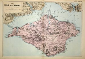
‘The ISLE OF WIGHT. REDUCED FROM THE ORDNANCE SURVEY’ by G. W. Bacon c.1895
£
36.00
Add to basket
Add to Wishlist
Add to Wishlist
‘THE KINGDOME OF ENGLAND’ by John Speed c.1676
£
1,650.00
Add to basket
Add to Wishlist
Add to Wishlist
‘THE KINGDOME OF SCOTLAND’ by John Speed c.1676
£
1,600.00
Add to basket
Add to Wishlist
Add to Wishlist
‘THE LAKES OF KILLARNEY AND SURROUNDING COUNTRY’ by G. W. Bacon c.1895
£
20.00
Add to basket
Add to Wishlist
Add to Wishlist
‘THE LOTHIANS, OR COUNTIES OF EDINBURGH, LINLITHGOW, AND HADDINGTON.’ by W. Hughes c.1868
£
25.00
Add to basket
Add to Wishlist
Add to Wishlist
‘THE NETHERLANDS including LIEGE’ [Belgium & Luxembourg] by Robert Wilkinson c.1809
£
36.00
Add to basket
Add to Wishlist
Add to Wishlist
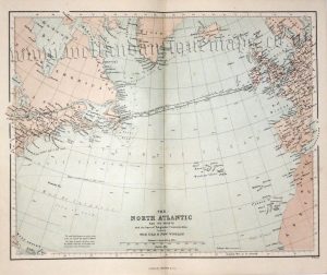
‘THE NORTH ATLANTIC AND ITS COASTS’ (Telegraphic Communication) by W. Hughes c.1868
£
20.00
Add to basket
Add to Wishlist
Add to Wishlist
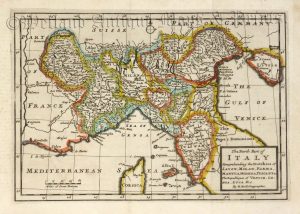
‘The North Part of ITALY Comprehending the Dutchies of SAVOY, MILAN, PARMA, MANTUA, MODENA, TUSCANY &c. The Republiques of VENICE, GENOA, LUCA & c.’ by H. Moll c.1711
£
120.00
Add to basket
Add to Wishlist
Add to Wishlist
‘THE NORTH RIDING OF YORKSHIRE’ by Robert Morden c.1695
£
155.00
Add to basket
Add to Wishlist
Add to Wishlist
‘THE NORTH RIDING OF YORKSHIRE’ by Robert Morden c.1722
£
165.00
Add to basket
Add to Wishlist
Add to Wishlist
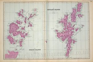
‘THE ORKNEY AND SHETLAND ISLANDS.’ by William Hughes c.1868
£
20.00
Add to basket
Add to Wishlist
Add to Wishlist
‘THE ORKNEY AND SHETLAND ISLANDS.’ by William Hughes c.1868
£
20.00
Add to basket
Add to Wishlist
Add to Wishlist
‘THE ORKNEY ISLANDS’ / ‘THE SHETLAND ISLANDS’ by E. Weller F.R.G.S. / G. W. Bacon c.1884
£
32.00
Add to basket
Add to Wishlist
Add to Wishlist
‘THE ORKNEY ISLANDS’ / ‘THE SHETLAND ISLANDS’ By Edward Weller F.R.G.S. c.1863
£
38.00
Add to basket
Add to Wishlist
Add to Wishlist
‘THE OUTER HEBRIDES.’ / ‘THE COUNTIES OF SUTHERLAND AND CAITHNESS.’ by W. Hughes c.1868
£
20.00
Add to basket
Add to Wishlist
Add to Wishlist
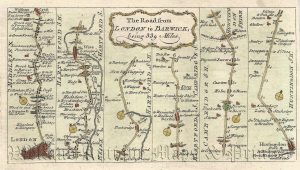
‘The Road from LONDON to BARWICK’ (London to Stilton) by Thomas Kitchin c.1767
£
40.00
Add to basket
Add to Wishlist
Add to Wishlist
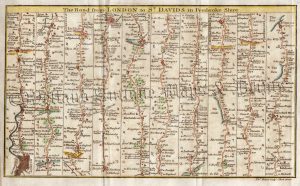
‘The Road from LONDON to ST. DAVIDS in Pembroke Shire.’ by T. Bowen / Gent. Mag. c.1765-1774
£
80.00
Add to basket
Add to Wishlist
Add to Wishlist
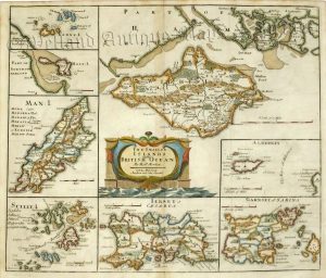
‘The Smaller ISLANDS – in the BRITISH OCEAN’ by J. Owen & E. Bowen c.1736
£
60.00
Add to basket
Add to Wishlist
Add to Wishlist
‘THE SMALLER ISLANDS in the BRITISH OCEAN’ by Robert Morden c.1722
£
185.00
Add to basket
Add to Wishlist
Add to Wishlist
‘The WEST RIDING of YORK SHIRE Drawn from an ACTUAL SURVEY …’ by Thomas Kitchin (ex ‘London Magazine’) c.1749
£
110.00
Add to basket
Add to Wishlist
Add to Wishlist
‘THE WEST RIDING of YORKSHIRE’ by J. Owen & E. Bowen c.1736
£
65.00
Add to basket
Add to Wishlist
Add to Wishlist
‘THE WEST RIDING OF YORKSHIRE’ by John Bartholomew F.R.G.S. / Philip & Son c.1876
£
20.00
Add to basket
Add to Wishlist
Add to Wishlist
Out of stock
‘THE WEST RIDING of YORKSHIRE’ by Robert Morden c.1695 (First Edition)
£
275.00
Read more
Add to Wishlist
Add to Wishlist
Out of stock
‘THE WORLD (on Mercator’s Projection)’ by T. Starling c.1832
£
55.00
Read more
Add to Wishlist
Add to Wishlist
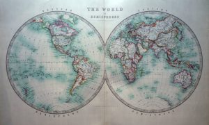
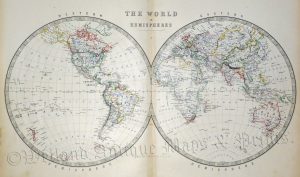
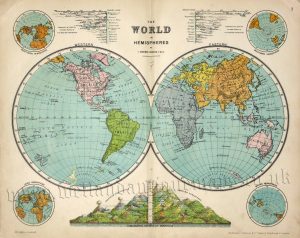
‘THE WORLD IN HEMISPHERES’ by Keith Johnston F. R. S. E. c.1904
£
80.00
Add to basket
Add to Wishlist
Add to Wishlist
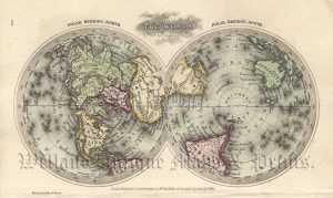
‘THE WORLD IN HEMISPHERES’ by Keith Johnstone F.R.S.E. c.1861
£
95.00
Add to basket
Add to Wishlist
Add to Wishlist
‘THE WORLD IN HEMISPHERES’ by T. Ruddiman Johnston c.1890
£
46.00
Add to basket
Add to Wishlist
Add to Wishlist
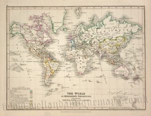
‘THE WORLD IN MERCATOR’S PROJECTION. distinguishing the PRINCIPAL STATES and their COLONIES’ by J. Dower / A. Petermann F.R.G.S. c.1850
£
60.00
Add to basket
Add to Wishlist
Add to Wishlist
‘THE WORLD ON MERCATOR’S PROJECTION SHEWING THE VOYAGES OF CAPTAIN COOK ROUND THE WORLD’ by J. Rapkin / J. Tallis c.1849
£
125.00
Add to basket
Add to Wishlist
Add to Wishlist
Out of stock
‘THE WORLD ON MERCATOR’S PROJECTION’ by John Tallis / J. Rapkin c.1853
£
225.00
Read more
Add to Wishlist
Add to Wishlist
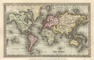
‘THE WORLD’ by T. Starling c.1832
£
65.00
Add to basket
Add to Wishlist
Add to Wishlist
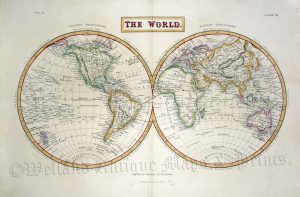
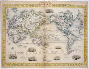
‘THE WORLD.’ by Sydney Hall c.1856
£
120.00
Add to basket
Add to Wishlist
Add to Wishlist
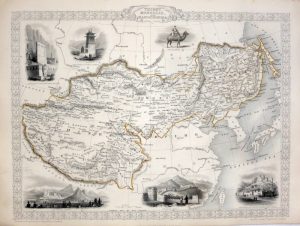
‘THIBET MONGOLIA AND MANDCHOURIA’ by John Tallis / J. Rapkin c.1851
£
125.00
Add to basket
Add to Wishlist
Add to Wishlist
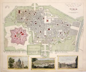
‘TURIN (TORINO)’ by W. B. Clarke / J. Henshall (S. D. U. K.) c.1833
£
110.00
Add to basket
Add to Wishlist
Add to Wishlist
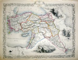
‘TURKEY IN ASIA’ (Turkey and the Middle East) by J. Tallis / J. Rapkin c.1851
£
75.00
Add to basket
Add to Wishlist
Add to Wishlist
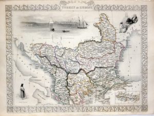
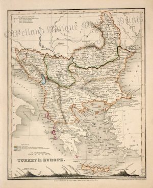
‘TURKEY IN EUROPE’ by John Tallis / J. Rapkin c.1851
£
65.00
Add to basket
Add to Wishlist
Add to Wishlist
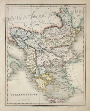
‘TURKEY in EUROPE.’ (The Balkans) by J. Dower c.1842
£
32.00
Add to basket
Add to Wishlist
Add to Wishlist
‘TURKEY in EUROPE.’ by Dower / Pertermann c.1850
£
36.00
Add to basket
Add to Wishlist
Add to Wishlist
Out of stock
‘TWEED MANUFACTURING DISTRICTS’ (Scotland) by J. Bartholomew c.1885
£
28.00
Read more
Add to Wishlist
Add to Wishlist
←
1
2
3
…
51
52
53
54
55
56
57
…
64
65
66
→
Home
About Us
Contact Us
Feedback
Recent Additions
Shop Online
Login
Register
Shopping Basket
Scroll to Top
Orders made between April 29th to May 5th will be updated on May 6th.
Learn more
This is default text for notification bar
Learn more


!['THE NETHERLANDS including LIEGE' [Belgium & Luxembourg] by Robert Wilkinson c.1809](https://www.wellandantiquemaps.co.uk/wp-content/uploads/2023/01/Netherlands-Wilkinson-01-copy-300x237.jpg)